dailyloe.com – A powerful storm system is targeting the Central United States through the Easter weekend, bringing severe weather risks from Texas to the Great Lakes. The multi-day event threatens to disrupt travel and outdoor plans with dangerous conditions. Meteorologists warn the greatest hazards may occur after dark.
On Tuesday, the severe weather risk spans approximately 1,400 miles from central Texas to upstate New York. AccuWeather meteorologist Brandon Buckingham indicates the greatest concentration of storms will be from southern Michigan to northwest Pennsylvania. These storms may produce large hail, damaging wind gusts, and a few tornadoes.
The AccuWeather Local StormMax™ model predicts wind gusts could reach 85 mph in the most intense cells. The threat shifts southward on Wednesday, consolidating over the South Central states. Severe weather is anticipated from central Texas through Kansas and into southwestern Missouri.
A concentrated zone of severe storms is likely from north-central Texas into central Oklahoma. This area includes major cities like Dallas, Tulsa, and Oklahoma City. The primary threats remain large hail, damaging winds, and isolated tornadoes.

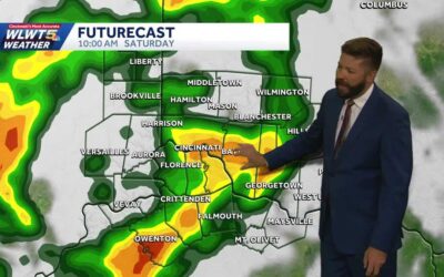
Farther east, heavy thunderstorms will drench the Ohio Valley and mid-Atlantic region on Wednesday. These storms will bring downpours capable of slowing travel and causing localized flooding. Some cells may also produce strong, gusty winds.
The persistent nature of this system raises concerns for flooding, especially in areas receiving repeated heavy rainfall. Residents across the affected regions are advised to monitor forecasts closely. Outdoor and travel plans should be reconsidered as conditions deteriorate.[]
Source: Yahoo